
Estero ZIP Directory Coverage
The Village's official 2018 notice identified five postal codes inside incorporated Estero. That statement documents a local overlap problem, not a claim that every address in each code is within the Village. The ZIP coverage table distinguishes the core Estero identity from northern and southern edges that use Fort Myers or Bonita Springs postal names.
| ZIP Code | Areas Covered | Post Office | Notes |
|---|---|---|---|
| 33928 | Core Estero, Corkscrew Road, Village Hall, planned communities | Estero Post Office | Main postal identity; delivery area can cross legal lines |
| 33929 | Estero-associated area named by the Village | Verify with USPS | Official source did not establish precise current status |
| 33967 | North and east Estero area, Three Oaks overlap | Verify with USPS | May use Fort Myers or Estero city label |
| 34134 | Southern and western edge | Verify with USPS | Bonita Springs association; only part intersects Estero |
| 34135 | Southern and eastern edge | Verify with USPS | ZIP totals include land outside Estero |
The main Estero Post Office is at 20791 Three Oaks Parkway in 33928. For the other codes, use an address-level postal check rather than assuming a station, PO-box status, or delivery area. The research did not verify that 33929 is now a PO-box-only code, so the Estero ZIP code directory leaves that point open instead of guessing.
Why Estero Has Five ZIPs
Modern Estero incorporated on December 31, 2014, but incorporation did not create a new postal system. In 2018, Village officials discussed seeking a unique ZIP because five codes crossed the municipal boundary and caused delivery and civic-identity confusion. The episode shows why a postal city cannot prove legal jurisdiction.
The Village grew inside delivery routes already tied to Estero, Fort Myers, and Bonita Springs. Government records followed a different map. Lee County created parcel and E911 identifiers, the Village drew its incorporated line, and USPS maintained delivery geography. A good ZIP lookup keeps these layers separate.
The official Village explanation is captured below. Read the Estero five-ZIP notice before treating a postal label as a municipal fact.
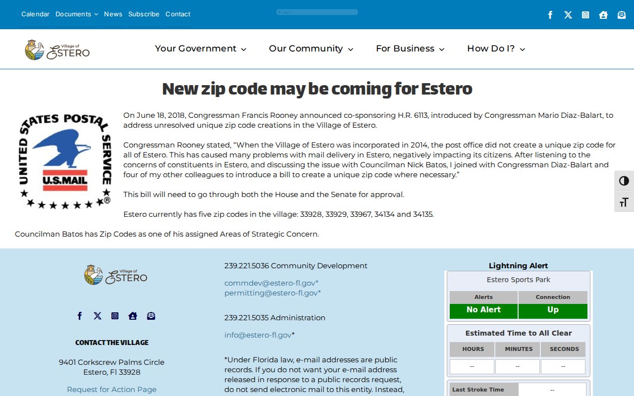
The notice is direct evidence that ZIP and Village boundaries diverge in Estero.
Estero ZIP 33928 Core
ZIP 33928 carries Estero's strongest postal identity. It includes Village Hall, Corkscrew Road addresses, and many planned communities. Even here, USPS delivery geography is not municipal law. A 33928 result narrows the search but still needs a parcel-boundary check when permits, taxes, services, or code jurisdiction matter.
Community and subdivision names can also differ from the recorded legal description. Planned developments, gated communities, condominiums, and trusts are common. Search the street address in the postal tool, then use the parcel's site address and legal subdivision name. An owner mailing address may be outside Florida because seasonal ownership is common.
Village demographics show why broad ZIP totals can mislead. Estero had 38,443 residents in the 2024 estimate and about 25,854 households on the Village demographic page, but neither figure is a total for 33928. Open the Estero demographics source for the municipal context.
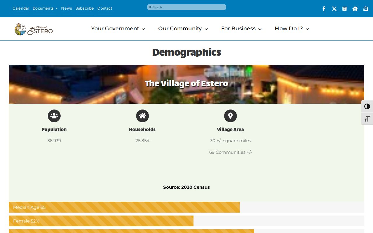
The figures describe the Village boundary, not every delivery address that shares an Estero ZIP code.
Estero Postal Edge Overlaps
ZIP 33967 is the northern and eastern overlap, including Three Oaks and addresses that may use Fort Myers or Estero labels. ZIPs 34134 and 34135 touch the southern side and are associated with Bonita Springs. Only portions of those broad postal areas intersect the Village. ZIP 33929 appears in the Village's five-code statement, but the available official material does not define its exact present delivery or box-only footprint.
Try both the postal city and the legal municipality when an index relies on text. Then switch to a stable parcel key. A STRAP is Lee County's 17-character parcel identifier. The folio is another numeric parcel key. Neither should be confused with a ZIP, and both are better than a marketing community name for connecting records.
Boundary check. Use USPS for mail delivery and GeoView for Village jurisdiction; the two answers serve different purposes.
Find Estero Records by ZIP
The local property system accepts a postal code, but broad searches can produce parcels beyond Estero. The Lee Property Data Search pairs postal code with site or owner information. GeoView adds ZIP and municipal-boundary layers. Voter records have a different access model: the state status page is a self-lookup, while geography-based data comes through an official extract request.
- Enter the full address in USPS lookup and record the delivery ZIP.
- Search the Lee property roll by postal code, street, or parcel key.
- Open GeoView and enable ZIP Codes and Village of Estero boundaries.
- Narrow the selected parcels because the map caps a selection at 1,000.
- Use an authorized voter extract request only when that data is needed lawfully.
Once a ZIP narrows the area, the Estero street directory gives the address-level workflow. It separates the physical site address from the owner's mailing address and uses the legal description to connect parcel records.
Estero Postal Search Fields
The Property Appraiser offers more than a general address box. Ordinary real-property search accepts postal code along with site or owner information. Tangible-property search can combine ZIP with street number and name. Owner Info searches the tax-roll mailing address, while Site Info searches the parcel's physical location. Those are different address sets.
| Field | Search role | Estero caution |
|---|---|---|
| Postal Code | Filters property results by ZIP | Can include land outside the Village |
| Site Address | Locates the physical parcel | Maintained through E911 data |
| Owner Mailing | Finds the tax mailing address | May be outside Florida |
| STRAP or Folio | Targets one parcel | More stable than a postal label |
| Legal Description | Links title and subdivision | Best bridge when an address changes |
A ZIP-wide export still describes owners of record, not all occupants. Trusts and LLCs can appear in place of personal names. Confirm entity names in official filings, and do not turn a parcel list into claims about who currently lives inside each home.
Verify Every Estero ZIP
The postal service is the authority for the delivery code assigned to a complete address. Open the USPS ZIP Code Lookup, enter the street, city, and state, and save the standardized result. USPS may accept a preferred or alternate city label, which still does not settle municipal jurisdiction.
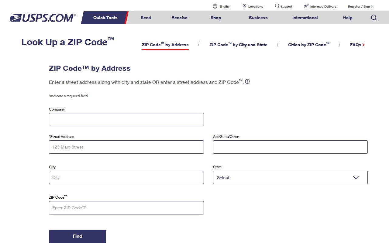
The result supplies the delivery ZIP and standardized address needed for the next property search.
When voter geography matters, Florida's authenticated lookup asks for first name, last name, birth date, and acceptance of its lawful-use warning. It is designed for the voter checking his or her own status. The official Florida voter status lookup can confirm assigned voting information after identity inputs.
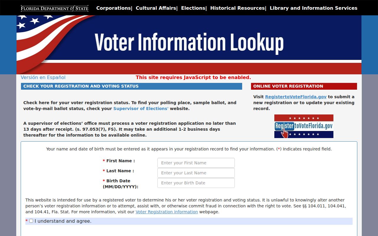
The form demonstrates why the self-service voter tool cannot function as an open ZIP code directory.
Estero ZIP Voter Extracts
Florida's monthly voter extract is the formal route for broader voter data. The file includes active and inactive voters from the prior month and carries residence and mailing ZIP fields, precincts, districts, status, and dated participation codes. Protected fields are omitted, and Address Confidentiality Program participants are excluded entirely. Participation history never shows a ballot choice.
Requests go through the Florida voter extract process with contact and mailing details at least 24 hours before scheduled availability. Delivery is by mailed disk or pickup, not email. Lee County also accepts public-record requests and lists a $10 CSV for registered-voter data. Fees or extensive-use estimates should be checked with the custodian before ordering.
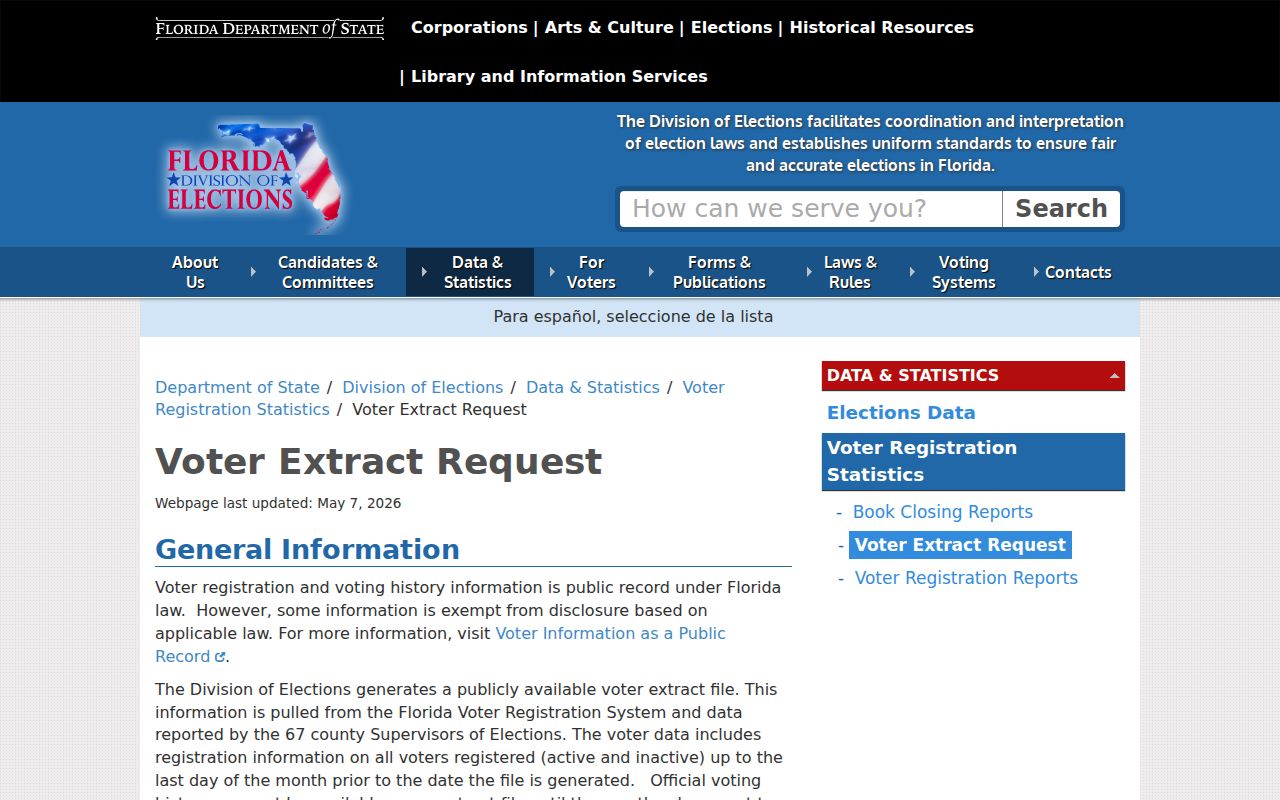
The extract is a dated official roll with statutory exclusions, not proof of present occupancy at every listed address.
Estero ZIP Totals Differ
Population and household counts must use matching boundaries. Census place data measures the Village of Estero. A ZIP Code Tabulation Area is a Census approximation of mail geography, and a USPS ZIP is an operating delivery route. These shapes can overlap without matching. Combining their figures produces a false total.
Estero's planned communities add another wrinkle. The Village reports roughly 69 communities, and many residents are seasonal. Owner mailing addresses often leave Florida, while the parcel remains in Estero. Thus a property count, voter count, household estimate, and postal delivery count can all be valid yet answer different questions.
Note: Label every total with its year, source, and geography before comparing one Estero ZIP code with the incorporated Village.
Estero ZIPs Versus Village Limits
ZIP boundaries answer where mail goes. The Village line answers which municipality governs a parcel. For an Estero address, verify the ZIP with USPS, identify the parcel in the Property Appraiser search, then enable GeoView's ZIP Codes and Village of Estero layers. Taxes, permits, and code jurisdiction follow the government boundary. Preferred postal wording does not change that result.
- ZIP versus ZIP+4
- A ZIP covers a delivery area; the added four digits narrow delivery to a smaller segment.
- PO-box ZIP
- A code used primarily or only for post-office boxes rather than street delivery.
- Unique ZIP
- A code assigned to one large organization or institution.
- Carrier route
- The sequence of addresses served by one postal delivery route.
GeoView's 1,000-parcel selection ceiling also limits broad ZIP analysis. Narrow by street, subdivision, or parcel number before selecting records. When an address has changed, use alternate-address history, E911 data, plats, and legal description rather than forcing the old name into a current postal box.